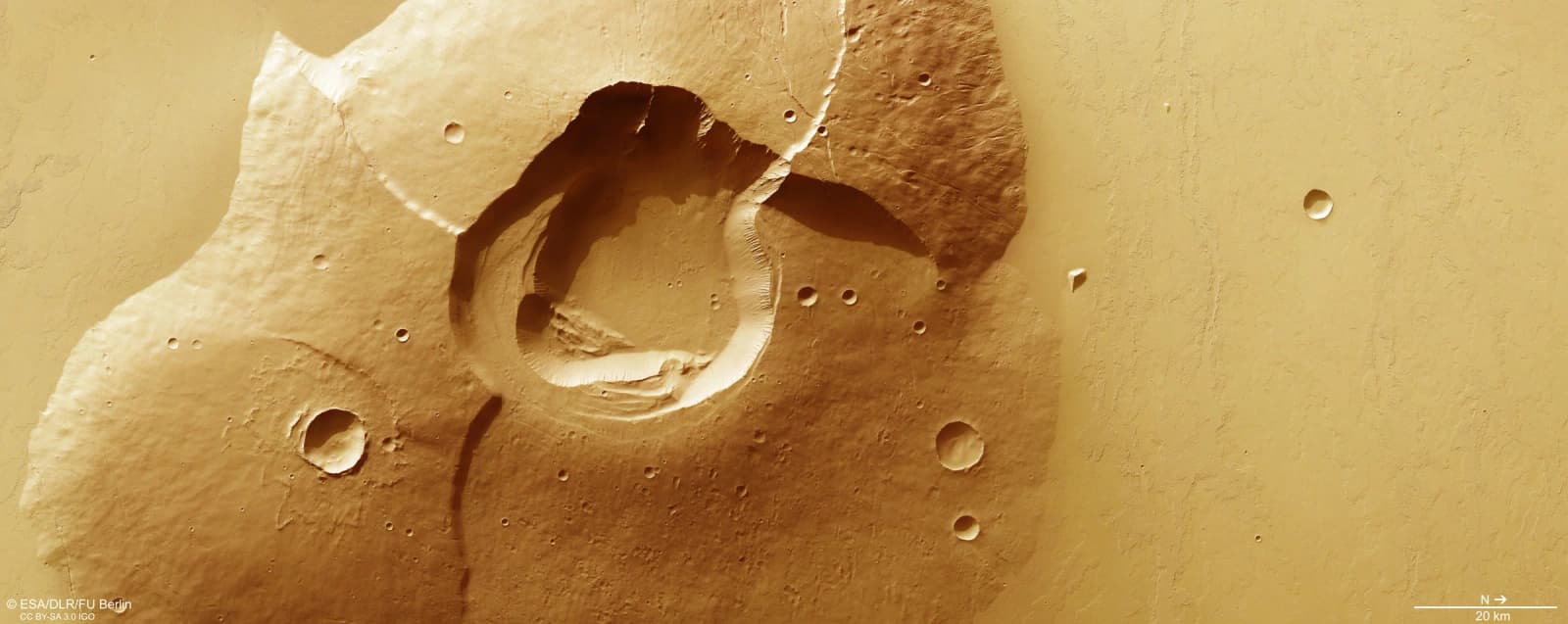
The European Space Agency (ESA) on 18 November released new images from its Mars Express orbiter of Tharsis Tholus, a Martian volcano about 8 kilometres tall whose summit has caved in to form a pit nearly 3 kilometres deep. The views, published as the mission's monthly image release, show a mountain that has collapsed at least twice and is crossed by faults, cliffs and landslides.
A volcano in the shadow of bigger ones
Tharsis Tholus lies in Tharsis, the volcanic region of Mars that also holds the planet's best-known giants. ESA said the volcano is roughly as tall as the highest peaks of the Himalayas, yet it is dwarfed by its neighbours. Olympus Mons, which stands nearly 22 kilometres high, lies about 2,500 kilometres to the west, while Arsia, Pavonis and Ascraeus Mons are shorter than Olympus Mons but still taller than any mountain on Earth.
According to ESA, volcanoes on Mars can grow so large because the planet has weaker gravity, no active plate tectonics and little ongoing erosion to wear them down.
What the images show
The most striking feature is the caldera, the large depression at the summit that forms when a volcano's top collapses. ESA said Tharsis Tholus went through at least two such collapses, leaving an older outer caldera and a younger inner one. At close to 3 kilometres deep, the caldera is unusually large compared with the size of the volcano itself, the agency said.
The flanks slope at about 10 degrees from horizontal, which ESA described as steeper than Mauna Kea in Hawaii but gentler than Vesuvius in Italy. The images also reveal several scarps, or cliff-like steps, which ESA said were probably created as the weight of the volcano warped softer layers of ground beneath it. Faults, sunken blocks of crust called grabens, gullies on the rim and walls of the caldera, and landslides that have slid into the central pit are also visible.
ESA said the volcano began forming about 3.8 billion years ago, and its last known lava flow dates to about 0.2 billion years ago.
How the pictures were made
The images come from the High Resolution Stereo Camera (HRSC) on Mars Express, which was developed and is operated by the German Aerospace Center (DLR). The data were captured on 15 June 2026 during orbit 28331, and the scene is centred near 13°N, 269°E, ESA said. The original image has a ground resolution of about 18 metres per pixel.
Because no colour data were available from that orbit, the colours were taken from two earlier orbits, 17050 and 17444. In the 3D views the vertical scale has been exaggerated three times to make the volcano's shape easier to see. ESA said the image products were processed at DLR's Institute of Space Research in Berlin-Adlershof and created by the Planetary Science and Remote Sensing group at Freie Universität Berlin.
Alongside the main view, ESA published a context map, a bird's-eye 3D view, a view of the flanks, a topographic map and a stereoscopic image that can be seen with red-blue 3D glasses.
Why it matters
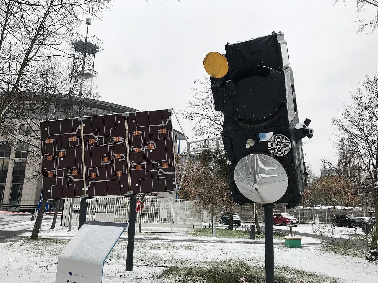
Mars Express launched in 2003 and carries eight instruments. ESA said the spacecraft has mapped Mars in colour and in 3D for more than two decades, building up a long record of the planet's surface. Detailed looks at individual volcanoes such as Tharsis Tholus help scientists piece together how and when volcanic activity shaped the Red Planet.
What next
The Tharsis Tholus release is part of ESA's regular series of Mars Express images, and the full-resolution files have been made available for public download on the agency's website.
PS · ESA/DLR/FU Berlin, CC BY-SA 3.0 IGO