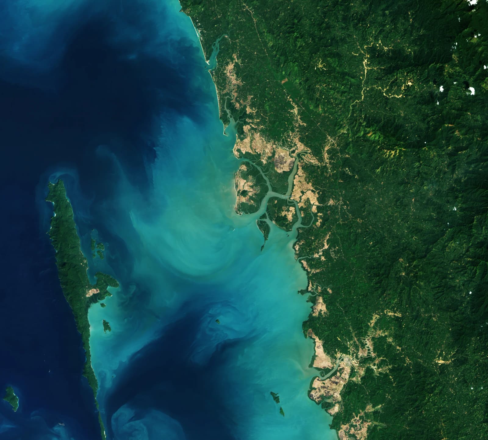
After decades of loss, the world's mangrove forests are growing again. NASA's Earth Observatory on 13 November 2026 published new Landsat satellite images from Myanmar showing coastal mangroves taking root on abandoned rice fields, illustrating a global turnaround that scientists say began around 2010.
The images accompany findings from a study in the journal Science led by Zhen Zhang of Tulane University, titled "Unexpected expansion and regrowth in Earth's mangrove forests over the past four decades".
Four decades of satellite records
Satellites have been used to map mangroves since the 1970s, after the first Landsat mission was launched. For the new study, researchers examined Landsat imagery from 1984 to 2023 to follow changes in both the extent and the density of mangrove canopies.
According to NASA's summary of the research, close to 3,000 square kilometres of mangroves were lost between 1984 and 2010. After 2010, the trend reversed and mangrove cover grew by almost 2,000 square kilometres, with the expansion led by Asia, Australia and South America. Many forests also now have thicker, more closed canopies than they did in 2010, particularly in South America.
Zhang said about two-thirds of the new growth came from mangroves colonising fresh ground, while about one-third came from restoration and regrowth in degraded areas, NASA reported.
Myanmar: from rapid loss to recovery
Myanmar is one of the clearest examples. NASA noted that the country's mangroves disappeared quickly in the 1980s and 1990s as land was cleared for agriculture and aquaculture and trees were cut for firewood. Between the 1980s and 2010, Myanmar lost 28.6 per cent of its mangrove area, but it has since regained around 10 per cent.
The study's authors attribute the reversal to greater awareness and restoration work after the 2004 Indian Ocean tsunami, stronger legal protection for forests, and sediment that built up new mudflats where mangroves could settle. The featured pair of images, captured by Landsat 5 on 14 February 2010 and Landsat 9 on 2 February 2026, show Palaw Township in Myeik District, where mangroves are reclaiming abandoned paddy fields south of Kyauktaung.
Gains and losses elsewhere
The picture is not uniform. NASA said fresh sediment has created new mudflats near the mouth of the Amazon and in northern Australia, where mangroves have been steadily gaining since the 1990s. Warmer conditions and fewer freezes have also let mangroves push into cooler fringe zones such as the south-eastern United States.
Losses, however, still outweigh gains in the Niger Delta, which has pulled down mangrove area in West and Central Africa since 2010. North America and southern Africa have also seen widespread damage after tropical cyclones.
Why it matters
Mangroves are coastal trees that average about 13 metres in height, yet their ecosystems can store up to four times as much carbon as taller inland tropical forests, NASA noted. They shield shorelines from erosion and storm surges, and their tangled roots serve as habitat and nurseries for fish, shrimp, crabs and other marine life. A recovery in these forests therefore has implications for climate, coastal safety and fisheries.
What happens next
Zhang cautioned against complacency, arguing that protecting existing forests and slowing deforestation, alongside natural expansion and regeneration, can produce large benefits. With Landsat continuing to image the world's coastlines, scientists will be able to track whether the post-2010 recovery holds in regions where pressures remain high.
PS · NASA Earth Observatory