Researchers at the National Aeronautics and Space Administration (NASA) have produced three-dimensional topography maps of the whole of the US state of California detailed enough to pick out individual trees, a tool they hope will help assess wildfire risk. NASA announced the work in a science news post on 18 November 2026.
The maps were built by NASA's Wildfire, Ecosystem Resilience, and Risk Assessment Initiative team, in partnership with the California Natural Resources Agency and the California Air Resources Board.
How were the maps made?
The team used airborne lidar, a technique that measures distance by bouncing laser pulses off the ground and vegetation. It drew on data from the US Geological Survey's 3D Elevation Program and combined it into one consistent statewide map.
Each pixel in the finished map covers 1 square metre, about 1.2 square yards. According to NASA, most lidar measurements taken from space have a resolution of 10 to 25 square metres per pixel, so the new dataset is far sharper than what satellites typically provide.
Why does tree-level detail matter for wildfire risk?
NASA said the maps resolve the landscape "down to the scale of a single tree". The team hopes the data will feed into products that assess wildfire risk, protect wildlife and ecosystems, and help manage natural resources across California.
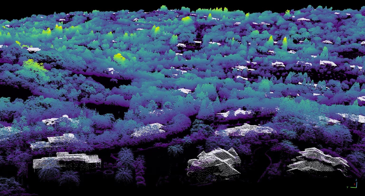
The image released with the announcement shows lidar data collected in 2020 over a wildland-urban interface in Santa Clara County, where wooded hillsides meet housing. In the rendering, trees appear as coloured point clouds and houses as white shapes, illustrating how closely the data can separate vegetation from buildings.
Who can use the data?
The dataset is public. NASA has made it available through its Earthdata catalogue, where researchers, planners and agencies can download it.
What has NASA not said yet?
The announcement does not describe specific wildfire risk products built from the maps so far, nor does it name the aircraft used to collect the lidar data. NASA presented the maps as a foundation that the team hopes will support such products.
The release comes a day after NASA said its long-serving Terra Earth-observing satellite will stop collecting data on 1 December.