
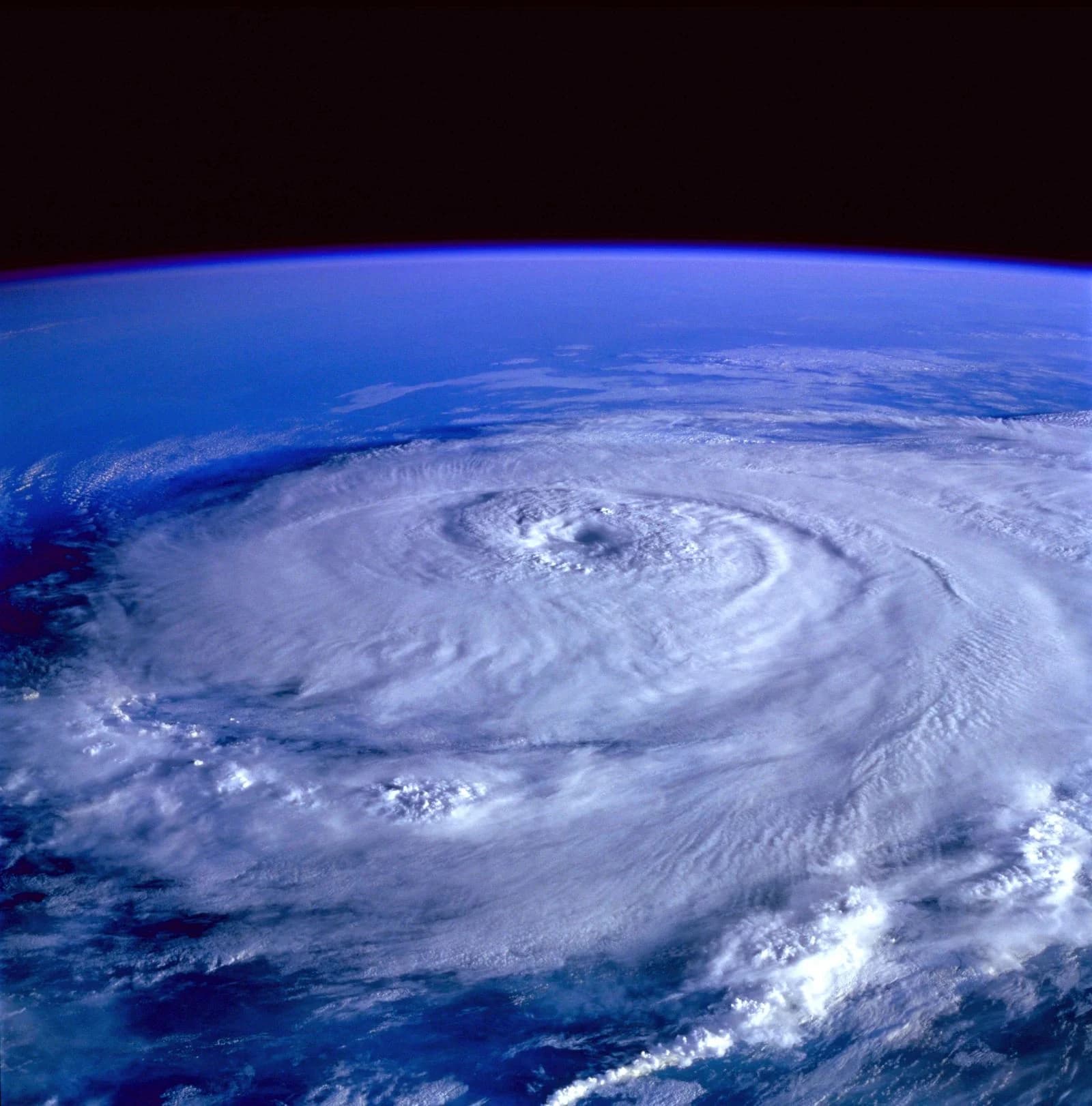
Update (16 November 2026, 06:36 IST): The system has strengthened into a deep depression. In its tropical weather outlook based on 1800 UTC observations, the IMD said the depression intensified at 11:30 pm IST on 15 November near latitude 10.6°N and longitude 86.7°E, about 870 km south-southeast of Visakhapatnam and 760 km east-southeast of Chennai, with maximum sustained winds of 30 knots gusting to 40 knots. The IMD said it is very likely to become a cyclonic storm around 5:30 pm IST on 16 November and to keep moving north-northwestwards towards the Andhra Pradesh coast.
The India Meteorological Department (IMD) on Sunday, 15 November 2026, put the coasts of Andhra Pradesh and adjoining south Odisha under a pre-cyclone watch after a weather system in the Bay of Bengal strengthened into a depression. In its 3:30 pm press release, the agency said the system is very likely to become a cyclonic storm on 16 November, a severe cyclonic storm on 17 November, and then a very severe cyclonic storm as it heads north-west towards the Andhra Pradesh coast.
This explainer builds on our earlier report, Bay of Bengal low may turn into cyclonic storm by Monday evening: IMD.
Once it reaches cyclonic storm strength, the system is expected to carry the name Akvan, the next name on the regional list maintained for the north Indian Ocean. Here is what the official forecast says, what is still open, and what it means for people in the affected states.
What happened on Sunday
According to the IMD, the depression formed at 5:30 am IST on 15 November over the southeast and adjoining southwest Bay of Bengal, near latitude 9.0°N and longitude 86.9°E. Over the next six hours it drifted north-north-west at about 15 kmph. At 11:30 am it was centred near 9.8°N, 86.8°E, roughly 620 km east-north-east of Trincomalee in Sri Lanka, 800 km east-south-east of Chennai, 960 km south-south-east of Visakhapatnam and 1,070 km south-south-east of Gopalpur in Odisha.
The department's National Bulletin No. 3, issued at 3 pm and addressed to the Union home ministry's disaster control room, the National Disaster Management Authority, the NDRF and the chief secretaries of coastal states, carried the same position and the pre-cyclone watch for Andhra Pradesh and south Odisha.
Background and timeline
The IMD has tracked the system for three days:
- 13 November, 5:30 am: a low-pressure area formed over the southeast Bay of Bengal.
- 14 November, 5:30 am: it became a well-marked low.
- 15 November, 5:30 am: it concentrated into a depression.
- 15 November, 11:30 pm (forecast): deep depression.
- 16 November: cyclonic storm over the central parts of the south and adjoining west-central Bay of Bengal.
- 17 November: severe cyclonic storm over the west-central Bay of Bengal.
- 18-19 November: further strengthening while moving north-west towards the Andhra Pradesh coast.
If it is named, it would be the third storm in a row from the current column of the list after Arnab, proposed by Bangladesh, and Murasu, proposed by India; Akvan is Iran's contribution. The Hans India reported on Sunday that Arnab and Murasu together killed 15 people and damaged infrastructure and crops in Andhra Pradesh, and that the new system would be the third cyclonic storm to approach the state's coast in about 20 days.
Verified data from the IMD forecast
The IMD's forecast table sets out how quickly the winds are expected to build:
- 15 November, 11:30 am: 45-55 kmph, gusting to 65 kmph (depression)
- 16 November, 11:30 am: 60-70 kmph, gusting to 80 kmph (cyclonic storm)
- 17 November, 11:30 am: 90-100 kmph, gusting to 110 kmph (severe cyclonic storm)
- 18 November, 11:30 pm: 115-125 kmph, gusting to 135 kmph (very severe cyclonic storm)
- 19 November, 11:30 am: 120-130 kmph, gusting to 145 kmph, near 16.2°N, 84.7°E
Rain: The IMD expects heavy rain at isolated places in coastal Andhra Pradesh on 18 November, followed by heavy to very heavy rain at a few places on 19 and 20 November, with isolated extremely heavy rainfall of 21 cm or more over north coastal Andhra Pradesh. Odisha could see heavy to very heavy rain at isolated places from 19 to 21 November. Heavy rain is also forecast at isolated places in Rayalaseema, Gangetic West Bengal, Telangana, Chhattisgarh and Jharkhand between 19 and 21 November.
Sea and wind: Along and off the Andhra Pradesh and Yanam coasts, winds are forecast to rise to gale force by 19 November and to 120-130 kmph gusting to 145 kmph from the evening of 19 November to the morning of 20 November, when the sea may turn "phenomenal", the IMD said.
Fishermen: Those at sea were told to return to the coast by 15 November. Fishing is advised against in the southwest Bay of Bengal from 15 to 19 November, in the central Bay from 16 to 20 November and in the northwest Bay on 19 and 20 November.
Perspectives
Andhra Pradesh: Prakhar Jain, managing director of the Andhra Pradesh State Disaster Management Authority, was quoted by The Hans India as saying north Andhra may get heavy rain with strong winds on Thursday and Friday. The paper said the administration had been put on high alert and listed Srikakulam, Vizianagaram, Visakhapatnam, Anakapalli and Alluri Sitarama Raju among districts in line for heavy rain.
Odisha: Manorama Mohanty, director of the IMD's regional centre in Bhubaneswar, told OTV the system is likely to become a severe cyclonic storm by 17 November. OTV reported that Odisha should stay mostly dry until rain begins on 18 November, with Puri, Ganjam and Gajapati facing the heaviest falls.
Tamil Nadu: On 14 November, VR Durai of the Area Cyclone Warning Centre in Chennai was quoted by The Federal, citing The New Indian Express, as saying that "in all probability" the system would head towards north Andhra Pradesh and south Odisha, and that the exact track would be known only after the storm forms.
What it means for Indian readers
- Coastal Andhra and south Odisha residents should follow district administration advisories closely between 18 and 20 November, the window the IMD flags for heavy rain, gales and rough seas.
- City commuters in the affected regions should plan for waterlogging, underpass closures and slower traffic, which the IMD lists among expected impacts.
- Farmers may see damage to horticulture and standing crops from flooding, according to the IMD's impact assessment.
- Fishing communities and port users face restrictions; the IMD has asked fisheries departments, harbour authorities and shipping and offshore operators to review preparedness for 15-20 November.
- Travellers on routes through coastal Andhra Pradesh and Odisha should check for disruptions closer to their dates, since the IMD notes that heavy rain may reduce visibility and disrupt traffic.
What is established
- A depression formed over the southeast and adjoining southwest Bay of Bengal at 5:30 am IST on 15 November, according to the IMD's press release.
- The IMD has issued a pre-cyclone watch for Andhra Pradesh and the adjoining south Odisha coasts.
- The IMD forecasts a cyclonic storm on 16 November and a severe cyclonic storm on 17 November, with movement towards the Andhra Pradesh coast after that. Officials in Bhubaneswar and Andhra Pradesh, quoted by local media, describe the same outlook.
- Fishermen at sea have been told to return to shore by 15 November.
- Akvan is the name that follows Murasu in the WMO/ESCAP list used for this region.
What is uncertain
- Landfall point and time: The IMD's 15 November bulletins do not give a landfall point; they say only that the system will move towards the Andhra Pradesh coast. The Hans India reported a possible strike on 18 or 19 November, while the IMD's coastal wind warning points to the strongest winds off Andhra Pradesh from the evening of 19 November.
- Peak strength: The IMD forecast shows the storm reaching very severe category by 18-19 November, but forecasts this far out can change, and the department has not yet said how strong it will be at landfall.
- Tamil Nadu's exposure: The Federal reported on 14 November, citing VR Durai, that models had ruled out the north Tamil Nadu coast for the track. However, the IMD's National Bulletin on 15 November still forecasts heavy to very heavy rain at isolated places over north Tamil Nadu, Puducherry and Karaikal on 18 and 19 November, even though the track points north.
- Location figures: OTV, citing an earlier update, placed the system about 1,130 km from Gopalpur and 1,010 km from Visakhapatnam, while the IMD's 11:30 am position put it 1,070 km and 960 km away. The gap reflects different bulletin times as the system moved.
What happens next
The IMD said its next press release will come at 2:30 pm IST on 16 November, around the time the system is expected to become a cyclonic storm. State disaster agencies in Andhra Pradesh and Odisha are expected to issue their own district-level advisories, and residents should rely on the IMD (mausam.imd.gov.in and rsmcnewdelhi.imd.gov.in) and their district administrations for updates.