
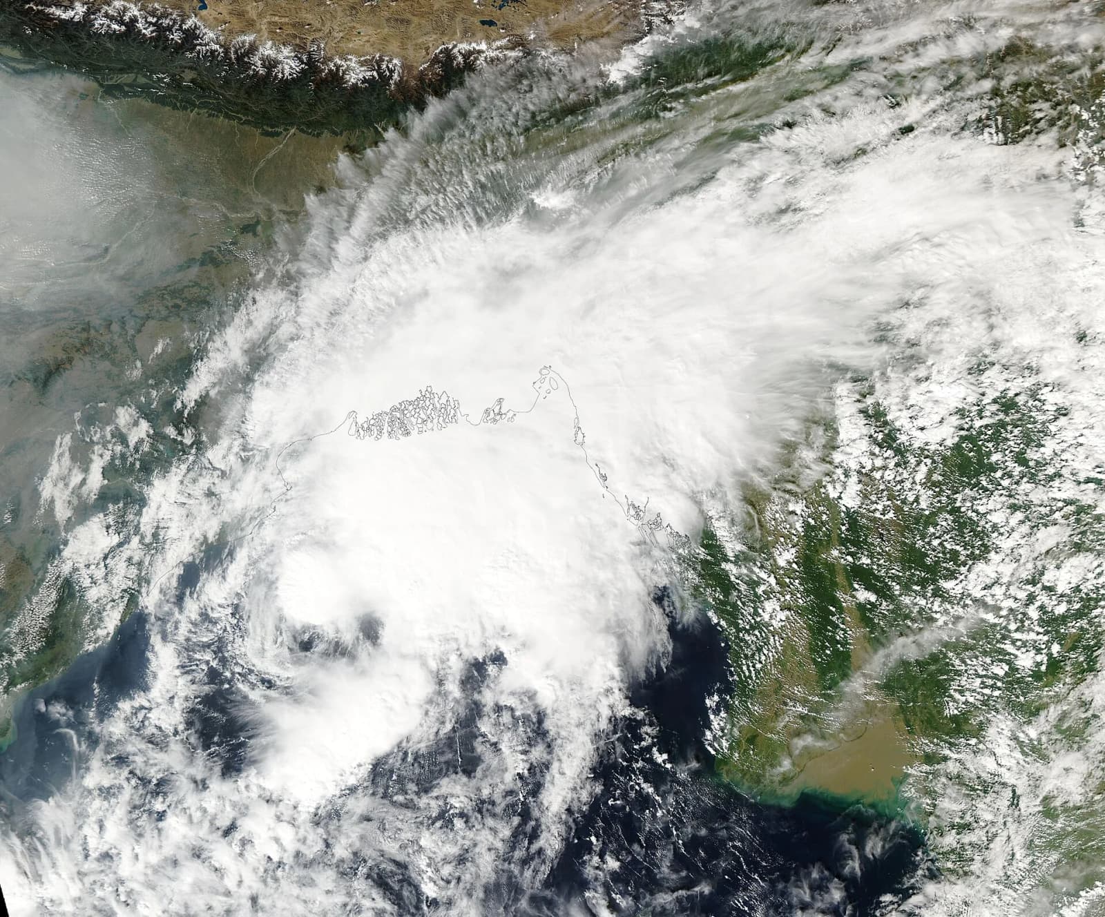
A weather system over the southeast Bay of Bengal is gathering strength and could become a cyclonic storm by the evening of Monday, 16 November 2026, the India Meteorological Department (IMD) has said. Fishermen already at sea have been told to head back to the coast, and squally weather is expected over the Andaman and Nicobar Islands.
Update (15 November 2026, 19:50 IST): The system intensified into a depression over the Bay of Bengal at 5:30 am on Sunday, the IMD said in a press release issued at 3:30 pm. The agency has put the coasts of Andhra Pradesh and adjoining south Odisha under a pre-cyclone watch and expects the depression to become a cyclonic storm on 16 November, a severe cyclonic storm on 17 November and later a very severe cyclonic storm as it moves north-west towards the Andhra Pradesh coast. Read our explainer.
According to All India Radio's news service, the IMD said on Sunday, 15 November, that a well-marked low-pressure area over the southeast Bay of Bengal is likely to intensify into a cyclonic storm by Monday evening, with heavy rain forecast over the Andaman and Nicobar Islands on Monday.
How the system has developed
The low-pressure area strengthened into a well-marked low at 5:30 am on Saturday, 14 November, Telangana Today and The Federal reported, citing the IMD. The weather office expected it to move northwest and become a depression over the same region within about 24 hours, then turn north-northwest and reach cyclonic-storm strength over the central Bay of Bengal around the evening of 16 November.
Winds and sea conditions
- Winds of up to 60 km/h are expected over the Andaman Sea, the Andaman and Nicobar Islands and large parts of the Bay of Bengal, All India Radio reported.
- Squalls of up to 80 km/h are forecast from 17 November for about two days, according to Telangana Today and The Federal; All India Radio said winds of that strength are expected over the central Bay of Bengal from Tuesday.
Warning for fishermen
The IMD advised fishermen at sea to return to the coast immediately, All India Radio said, and warned people against venturing into the Andaman Sea and the affected parts of the Bay of Bengal on Monday. Reports from 14 November said fishermen had been asked to be back on shore by 15 November and to stay off the sea while the system persists.
Where could it head?
The official track is not yet settled. The Federal, quoting comments given to The New Indian Express, reported that V R Durai, director of the Area Cyclone Warning Centre at the Regional Meteorological Centre, said models suggest the storm is unlikely to affect the north Tamil Nadu coast and is more likely to head towards north Andhra Pradesh and south Odisha. He added that the exact track would be known only after the cyclone forms on the evening of 16 November.
The same report said Tamil Nadu is expected to see relatively limited rain in the coming days, with moderate showers likely in Tenkasi, Thoothukudi, Tirunelveli and Kanyakumari districts on 17 and 18 November.
Weather elsewhere in India
All India Radio also reported IMD forecasts of thunderstorms with lightning and gusty winds over Rajasthan and Uttarakhand on Sunday, light to moderate rain or snowfall over the western Himalayan region due to a western disturbance, light rain over the northwest plains and dense fog at isolated places in west Uttar Pradesh.
Why it matters and what next
Coastal communities on India's east coast and island residents depend heavily on fishing, and early return to harbour is the main safeguard while a system intensifies at sea. The key moment is Monday evening: once the storm forms, the IMD's bulletins are expected to give a firmer track, likely landfall area and any district-level warnings. Residents of the Andaman and Nicobar Islands and the Andhra Pradesh and Odisha coasts should follow official IMD and state disaster management updates.