
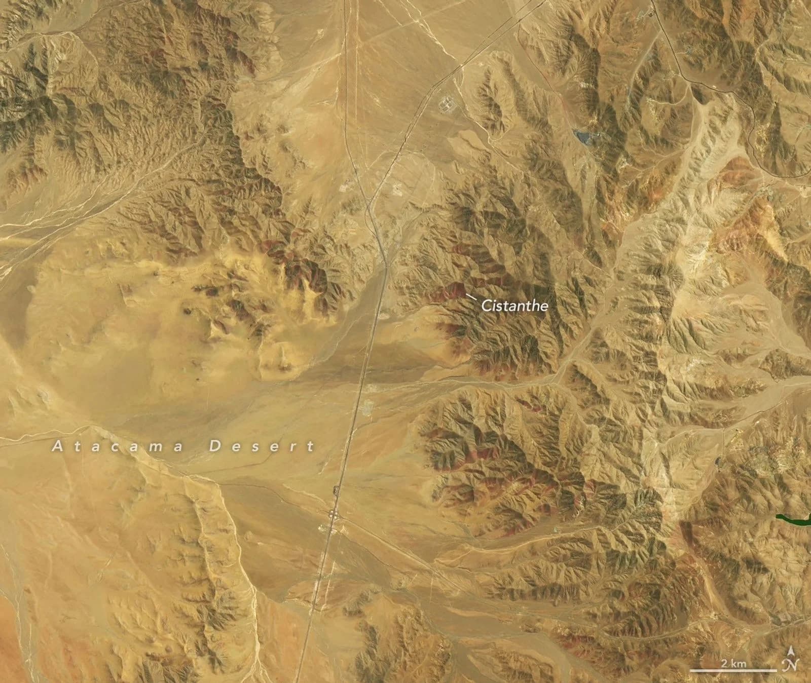
Winter rains in northern Chile have produced what scientists say may be the most extensive "desierto florido", or flowering desert, seen in the Atacama Desert since satellites began watching it, NASA's Earth Observatory reported on 19 November 2026. Landsat images published by NASA show hills south-west of the city of Copiapó turning green, white and then red-purple between mid-September and late October.
What do the satellite images show?
They show the bloom spreading and changing colour over about six weeks. NASA compared scenes from the Operational Land Imager on Landsat 8, taken on 14 September 2026, with scenes from the same type of instrument on Landsat 9, taken on 24 October 2026.
One pair covers an area about 30 km south-west of Copiapó, near the eastern sector of Desierto Florido National Park. By 24 October, red-purple patches had appeared there. Roberto O. Chávez, a remote sensing scientist at the Pontificia Universidad Católica de Valparaíso, identified them as Cistanthe blooms, most likely Cistanthe longiscapa.
A second pair, about 50 km south-west of Copiapó, inside an area flagged for its biological importance, shows green hillsides speckled with white in September. Andres Moreira-Muñoz, a plant geographer at the same university, said the white flowers were probably Nolana baccata. By late October most of the white had gone and red-purple patches had taken its place.
Why did the desert bloom this year?
NASA links the bloom to an unusually wet winter. From mid-July 2026, a series of storm fronts fed by an atmospheric river brought one of the heaviest July rain events in decades to a long stretch of Chile, from the Atacama region south to Los Lagos, citing Chile's national weather service, the Dirección Meteorológica de Chile. Back-to-back storms in August 2026 also brought rare snow to parts of the Atacama.
The rains coincided with a strengthening El Niño in the tropical Pacific. According to NASA, El Niño weakens the subtropical Pacific high, while a blocking high tends to form in the South Pacific near the tip of South America; together, these shifts push the Southern Hemisphere storm track towards the equator.
How unusual is it?
"It appears to be the most significant to date," Moreira-Muñoz said, adding that this held "at least since we began using remote sensing." Earlier research gives a sense of scale: a 2019 study led by Chávez used a long-term NASA vegetation record to identify 13 Atacama blooms between 1981 and 2015, and a 2014 study used Landsat to map flowering and fog-fed plants around the Copiapó dune field.
Researchers from the Pontificia Universidad Católica de Valparaíso also photographed the flowers on the ground, on 24 September and 24 October 2026, the Earth Observatory said. Their work was supported by a Chilean national research grant.
Why does it matter beyond Chile?
The bloom is a visible sign of how El Niño reshapes rainfall far from the Pacific Ocean where it forms. Satellites let scientists compare one season's bloom with decades of past records, which ground surveys alone cannot easily do across such a large, remote desert. MapMyTimes has also reported on other NASA Earth-observing work this week, including the end of science operations for the Terra satellite.
NASA did not say how long this year's bloom is expected to last.